


Zion Voting District, Pontotoc County, Mississippi
About
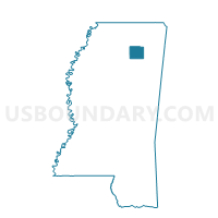
Outline

Summary
| Unique Area Identifier | 606515 |
| Name | Zion Voting District |
| County | Pontotoc County |
| State | Mississippi |
| Area (square miles) | 16.91 |
| Land Area (square miles) | 16.86 |
| Water Area (square miles) | 0.05 |
| % of Land Area | 99.68 |
| % of Water Area | 0.32 |
| Latitude of the Internal Point | 34.20498840 |
| Longtitude of the Internal Point | -88.87914300 |
Maps


Graphs
Select a template below for downloading or customizing gragh for Zion Voting District, Pontotoc County, Mississippi


Neighbors
Neighoring Voting District (by Name) Neighboring Voting District on the Map
- Bankhead Voting District, Pontotoc County, MS
- Hoyle Voting District, Pontotoc County, MS
- Palmetto A & B Voting District, Lee County, MS
- Pontotoc 4 Voting District, Pontotoc County, MS
- Woodland Voting District, Pontotoc County, MS
Top 10 Neighboring County Subdivision (by Population) Neighboring County Subdivision on the Map
Top 10 Neighboring Unified School District (by Population) Neighboring Unified School District on the Map
- Tupelo Public School District, MS (39,550)
- Lee County School District, MS (37,543)
- Pontotoc County Schools, MS (17,766)
- Pontotoc City Schools, MS (12,191)
Top 10 Neighboring State Legislative District Lower Chamber (by Population) Neighboring State Legislative District Lower Chamber on the Map
Top 10 Neighboring State Legislative District Upper Chamber (by Population) Neighboring State Legislative District Upper Chamber on the Map
Top 10 Neighboring 111th Congressional District (by Population) Neighboring 111th Congressional District on the Map
Top 10 Neighboring Census Tract (by Population) Neighboring Census Tract on the Map
- Census Tract 9504, Pontotoc County, MS (5,080)
- Census Tract 9501.01, Pontotoc County, MS (4,139)
- Census Tract 9504.01, Lee County, MS (3,988)
- Census Tract 9510.01, Lee County, MS (3,850)